


... which is Hopi for 'Grand Canyon'. My stepfather and I continued our trip to northern arizona
to the western entrance of the Grand Canyon. We stayed overnight at the Red Feather Inn just
south of the entrance which was a Native American establishment which was very nice. Fortunately
for us, it was the off-season as the usual one-night stay would have been around $180! Another
surprise and reminder at just how little water there is in this area, was the sticker on the bathroom
mirror pointing out that all water used in this area was trucked in. I delayed in editing/uploading
these pictures because I had so many, and I felt that I would be unable to even slightly reproduce
the colors and feel of standing on the south rim of the grand canyon. I would highly suggest that
anyone wanting to see the grand canyon visit during the off-season, as some of the roads only
open to tour/shuttle buses during the busy season, are completely open to traffic. There are
maybe a dozen or more stops along the south rim, and unbeknownst to me, the whole canyon
park area is over 200 miles long! If you look at a map of arizona, the whole top left half/area
is inside the grand canyon park region. From the south rim visitor's center, it is well over a
100 mile trip to the north rim visitor's area, unless you have a helicopter
I'll likely have two or three threads of canyon pictures, with lots of merged views
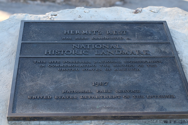
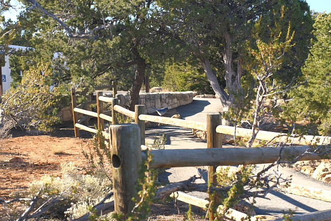
the viewing areas start at the west at Hermit's Rest; we traveled east
along the rim to the central visitor's center and a geology museum, and
then continued on our way to the easternmost viewing point and then southeast towards flagstaff
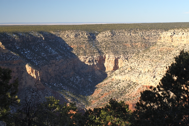
a short view to the southwest; the grand canyon is actually at fairly high
elevation, and is carved or stretched between two fairly flat highlands.
volcanos at one time on either side used to pour lava into the opening,
cutting off the flow of water
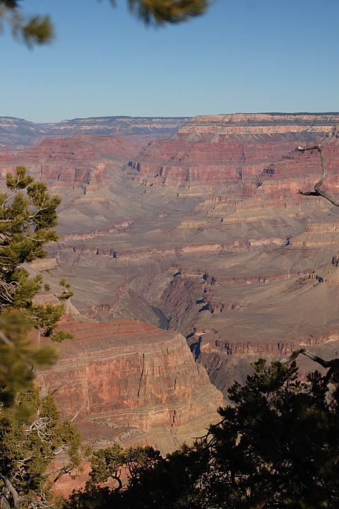
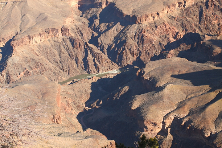
view to the far western canyon area and the colorado river
if you look closely in the middle of the image, you'll see a helicopter
that was flying very slowly, wayyyy down inside the canyon. the
pilot must be very careful as there are variable winds all through the area
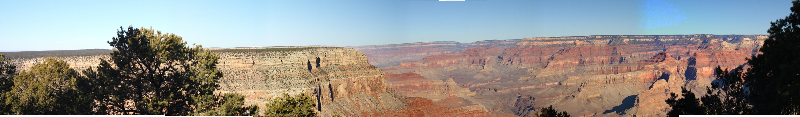
whole vista from hermit's rest point
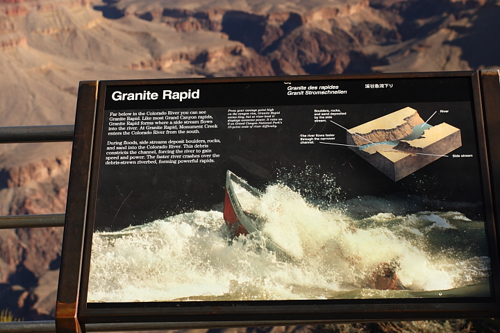
description of how an entering side-stream creates rapids
(image below is where the stream and river come together
and you can see the rapids)
mountain bluebird (I think, clarify if you know differently) in center
of image, at rest area/viewing point. these birds were all along the rim,
and were not reclusive unless you pointed a camera lens at them
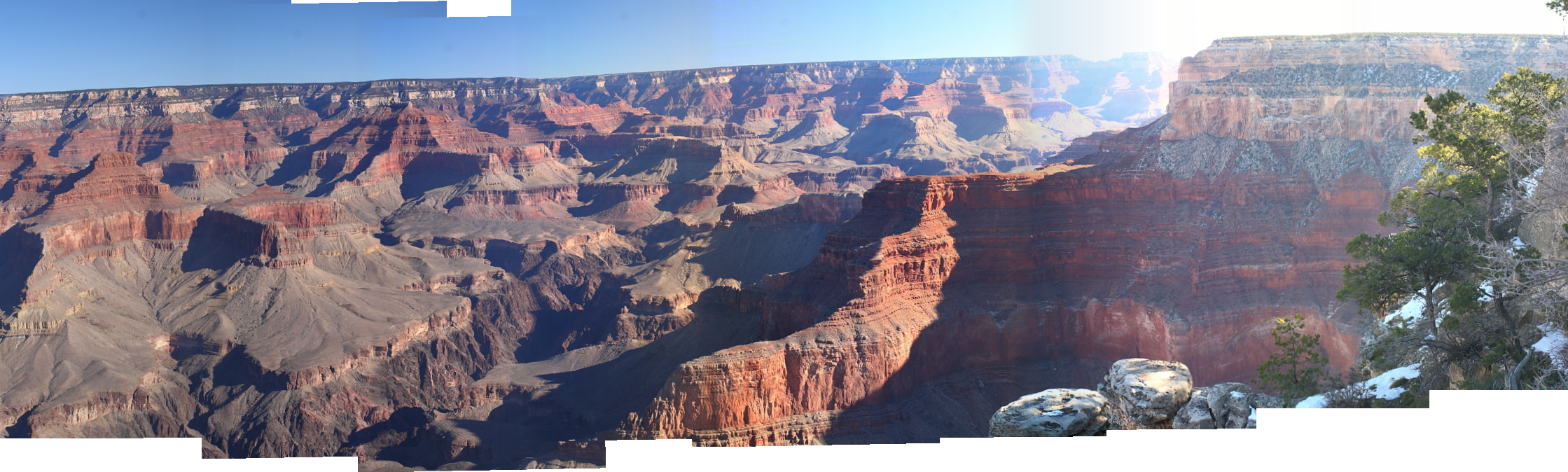
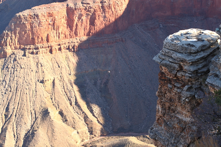
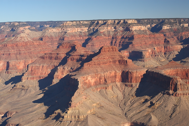
another merged view further east along the rim. the darker, deeper
cuts are through what is said to be the original molten material from
when the earth was formed. it is a little blurry, but there is also a
helicopter about three frames from the right. unfortunately it's in
the middle of a merge zone (where two frames came together)
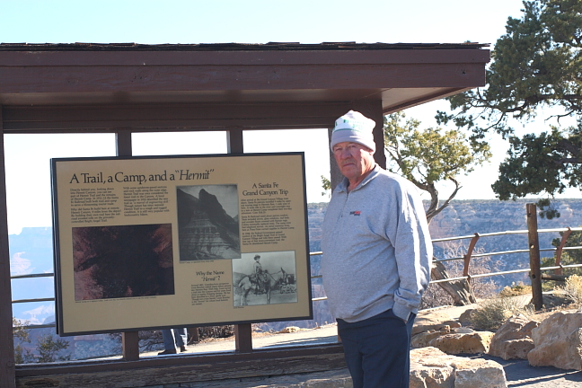
stepfather garnet
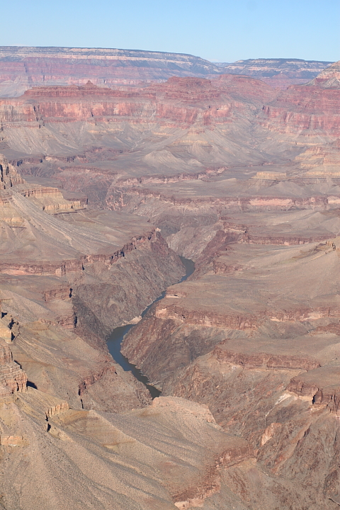
another view west along the colorado river
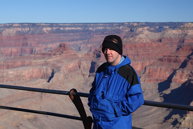
yours truly; if you think it looks cold outside, imagine standing on
the rim of a large canyon in winter with a good 10-15 mph breeze
blowing in places!
to the western entrance of the Grand Canyon. We stayed overnight at the Red Feather Inn just
south of the entrance which was a Native American establishment which was very nice. Fortunately
for us, it was the off-season as the usual one-night stay would have been around $180! Another
surprise and reminder at just how little water there is in this area, was the sticker on the bathroom
mirror pointing out that all water used in this area was trucked in. I delayed in editing/uploading
these pictures because I had so many, and I felt that I would be unable to even slightly reproduce
the colors and feel of standing on the south rim of the grand canyon. I would highly suggest that
anyone wanting to see the grand canyon visit during the off-season, as some of the roads only
open to tour/shuttle buses during the busy season, are completely open to traffic. There are
maybe a dozen or more stops along the south rim, and unbeknownst to me, the whole canyon
park area is over 200 miles long! If you look at a map of arizona, the whole top left half/area
is inside the grand canyon park region. From the south rim visitor's center, it is well over a
100 mile trip to the north rim visitor's area, unless you have a helicopter
I'll likely have two or three threads of canyon pictures, with lots of merged views
the viewing areas start at the west at Hermit's Rest; we traveled east
along the rim to the central visitor's center and a geology museum, and
then continued on our way to the easternmost viewing point and then southeast towards flagstaff
a short view to the southwest; the grand canyon is actually at fairly high
elevation, and is carved or stretched between two fairly flat highlands.
volcanos at one time on either side used to pour lava into the opening,
cutting off the flow of water
view to the far western canyon area and the colorado river
if you look closely in the middle of the image, you'll see a helicopter
that was flying very slowly, wayyyy down inside the canyon. the
pilot must be very careful as there are variable winds all through the area
whole vista from hermit's rest point
description of how an entering side-stream creates rapids
(image below is where the stream and river come together
and you can see the rapids)
mountain bluebird (I think, clarify if you know differently) in center
of image, at rest area/viewing point. these birds were all along the rim,
and were not reclusive unless you pointed a camera lens at them
another merged view further east along the rim. the darker, deeper
cuts are through what is said to be the original molten material from
when the earth was formed. it is a little blurry, but there is also a
helicopter about three frames from the right. unfortunately it's in
the middle of a merge zone (where two frames came together)
stepfather garnet
another view west along the colorado river
yours truly; if you think it looks cold outside, imagine standing on
the rim of a large canyon in winter with a good 10-15 mph breeze
blowing in places!


 :wink: